Showing posts with label hiking with kids (ANF). Show all posts

Tuesday, August 17, 2010

Recent Adventures


Would that every Southern California summer were this cool (current hot spell aside). My son and I have taken advantage of the weather to get out and about.

Our biggest recent adventure was a trek up the stream bed at Eaton Canyon. We were hoping to see frogs because there were so many tadpoles here in early summer.

Once we made it to the water, there was no stopping my three-year-old. Wearing his aquasocks (amphibious shoes), he trekked upstream, all the way to the bridge.

We didn't see any frogs, but were surprised by what appeared to be a couple of aquatic snakes, and oodles of dragon- and damselflies. We also scooped up aquatic bugs for a closer look with a magnifying glass.

My son was less keen on the terrestrial trek back to the car. But little doggies and girls commenting on his Kermit shirt kept him moving.

Once again, it was really hard to tear him away from the animal puppets at the nature center.

In late July we also enjoyed a visit to the Audubon Center at Debs Park. We spread a blanket next to a pond, and had a simple picnic. My son dug in the sand and climbed rocks; I enjoyed the birds and insects. Together we pretended to be bears in the little cave. Baby bear gave mom bear a time-out.

"Some people say personification of animals is a bad thing," says the Audubon Center's director Jeff Chapman, "but at a young age that kind of feeling and connecting with wildlife is a really good thing in my opinion. It’s a natural empathizing thing that young children have with animals."

Chapman encourages kids to share their discoveries on a board at the Center and on the nature website eBird (a joint project of Audubon and the Cornell Lab of Ornithology). "Audubon prides ourself on taking science and bringing it to regular people," he explains. "And allowing them to have a personal stake in feeding the world with information."

Find out about the other side of Debs Park.

Sunday, June 7, 2009

Nature Play at Eaton Cayon


You don't have to amble far to have a lot of fun outdoors. Case in point: our recent visit to Eaton Canyon. While waiting for our friends to arrive, we sauntered around the Junior Nature Trail, near the nature center. (You can pick up a free interpretive guide inside the nature center. Stop at the numbered posts and read the explanation in the pamphlet.) We listened to frogs in the pond, admired the showy penstemon (below),

watched a towhee hopping along the ground, saw a ground squirrel dash into his burrow, and snuck up on this cottontail:

The yuccas (Yucca whipplei) were in bloom. This plant is also known as "Our Lord's Candle" because when it flowers, its tall stock is topped with a large, flame-shaped cluster of creamy blossoms. In late day light, they seem to glow.

Inside the nature center, our son was fascinated by the snakes. Mom got giddy over the darling California and Pacific Tree Frogs. We both liked the tadpoles and Western Toad.

When our friends from Ramshackle Solid arrived, we hit the trail. We didn't get far, but it didn't matter. The boys had loads of fun climbing tree stumps, perching in the crotch of an old oak, balancing on rocks, digging in the dirt, and running wildly down the trail.


We plan to return to sample one of Family Nature Walks. They're free and happen every Saturday at 9:00 a.m. Eventually, I want to join one of the California Native Plant Society Walks that occur monthly, September through May.

More on hiking Eaton Canyon.

Thursday, May 21, 2009

Family Camping

CHILAO CAMPGROUND, ANGELES NATIONAL FOREST

I adore the Angeles Forest high country. The fact that it's only an hour's drive from my house only increases my admiration. The glorious conifers--Jeffrey, Coulter and Sugar Pines, Incense Cedars and Bigcone Doulas Firs--the exposed granite, the shushing of winds sliding up and down the canyons, the possibility of water and a wildlife encounter.

I've day hiked this forest a lot. But these days--with a little kid in tow--the best way to get at it is to camp. We recently invited our friends from Ramshackle Solid to join us at the Chilao Campgound, about 27 miles up the Angeles Crest Highway from La Canada. 

Chilao is a good choice if you're camping with young children. There are several flat campsites, piped water, and an easy trail nearby. We staked our tents at sites 3 & 4 in the Little Pines section of Chilao. (Like all campground in this forest, the only toilets are pit toilets, so don't look down! ) We arrived Thursday afternoon to enjoy a quieter campground. (It can be somewhat crowded here on summer weekends.)

Before leaving I called the district ranger's office to check conditions, verify water availability and campfire regulations, and get recommendations. The Forest Service also posts campground info on its website. In this forest "Be Aware of Bear Activity" means put all your food and smelly stuff (including toiletries) in your car. Try that in Sequoia National Park you'll be ticketed and perhaps have your car trashed by bears.

The ranger recommended the Little Pines Loop. It's not signed, but I guessed that it's this one: From Little Pines Campground head back to the main Chilao road. (This road loops from the campground to the picnic area and defunct visitor center.) Look for the trail that's behind the sign pointing to the campgrounds. We picked up the stretch of the trail that parallels the road. Much of it is flat, and fairly shady. 

It's a lovely trail, but I have to admit to some disappointment. Drought has really dried up the Chilao area. What I remembered as a lovely meadow with a tinkling creek was bone dry in early May. And it was hotter than I'd expected. I'm also wistful about the days when there was a sweet visitor center here. Sadly, the Forest Service has closed it indefinitely because of lack of money to repair, maintain and staff it. 

If you have older kids--or a baby that won't be hoofing it himself--I recommend the Buckhorn Campground, six miles up the road from Chilao

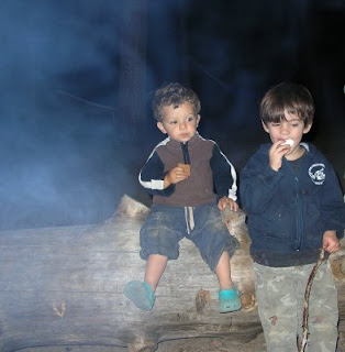
Once again, the highlight of the trip for our two-year-old was the campfire. This time he got to roast marshmallows--and make banana boats! Our friends showed us how to insert our marshmallows and chocolate into a banana, wrap it in foil and roast it.  

Another favorite campsite activity: swinging--and wrestling--in a pair of hammocks. I enjoyed a glimpse of some western bluebirds. Our friends spied on some grey squirrels. Scarlet bugler (Penstemon centrathifolius) and ceanothus were blooming around the campground.

We also sampled the silver moccasin trail, which runs through the area. You can pick it up next to Little Pines campsite #36 (or was it 38?).  Please bring a trail map/trail book with you. I use John Robinson's Trails of the Angeles (the 8th edition). But his map only includes the trails he describes, so I recommend picking up a topo map.  

Saturday we hiked a fire road from Cloudburst Summit into Cooper Canyon. The trail ultimately leads you into a gorgeous (steep) canyon and drops you at Buckhorn Campground, but we didn't get that far. (It's hike #61 in Trails of the Angeles.) The boys ran downhill exuberantly; then petered out and demanded to be carried back (uphill, of course). I enjoyed seeing the blooming lupine; we even got a look at a snow plant. This all red plant doesn't contain chlorophyll. It feeds off the roots of nearby pines and the humus that accumulates under them. 
Other good hikes for kids in the area
  • Charlton Flat to Vetter Mountain Lookout. It's two miles roundtrip, much of it on paved road. (#55 in Trails of the Angeles)
  • Chilao to Horse Flats. This trail is steeper. It's been a while since I hiked it, so it might not be ideal for little ones (#58 in book)
More on this trip from Ramshackle Solid.

Here's my camping checklist. And an Amazon link to the Robinson book. (Yes, I get %10 if you buy it from this link.) The campground fee is $12 a night.


Friday, April 3, 2009

Biking Adventure

River Ride in the Angeles National Forest

By bike or on foot, you won't forget this trip along the West Fork of the San Gabriel River in the Angeles National Forest. 

For those who don't know, LA County has three rivers: the Los Angeles, the San Gabriel and Santa Clara. The east and west forks of the San Gabriel converge in the mountains above Azusa, next to Highway 39, before pooling up behind two massive dams. 

You can ride regular street bikes along the West Fork; there is a paved, closed road that is smooth. On weekends, you'll find quite a few young riders here, as well as dog walkers, and fishermen. 

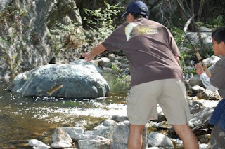
Our son loved getting his hands in the water. But most of all, he was excited to watch a man and his son catch three small brown trout (a non-native sport fish). For information on native trout, check out Cal Trout.


Remember that you need a license to fish. Please observe posted regulations.


Our two-year-old also caught a glimpse of a frog. And enjoyed climbing a big rock (with a little assistance).

In spring, the hillsides here are covered with blooming ceonothus

Most of the first four miles of this road is fairly flat. The confluence of the West Fork with Bear Creek is a nice spot to stop. The road gets steeper as you approach Glenn Trail Camp (mile 6) and, especially, Cogswell Reservoir (mile 8). But we didn't get that far. We were happy to enjoy the gorgeous scenery.

You can also picnic at tables near the parking lot. They overlook the river.

West Fork, San Gabriel River

From the 210 Freeway, exit Azusa Avenue (Hwy 39). If you don't already have one, pick up an adventure pass ($5) at one of the mini-marts along the road (they display signs). Drive north 8.5 miles, past Morris Reservoir and San Gabriel Reservoir. When the road splits at the top of the second dam, don't turn right onto East Fork Road, stay left and drive a little over a mile. (If you still need a pass, buy one at the Off-Highway Vehicle (OHV) area.) Slow as you approach a bridge over the river. The trailhead is on the near side of this bridge, most of the parking spaces are on the other side of the bridge.

Sunday, January 11, 2009

You'll Love This Spot


Monrovia Canyon Park


This is one of the sweetest of the easily accessible front-country spots in the San Gabriel Mountains. It's beautifully maintained by the city of Monrovia and volunteers. The addition of a darling nature center makes this a great place for families. 

If you're hiking with energetic kids over age 5 or 6--or a little baby you plan to carry the entire way--you can opt for hiking the entire 1.7 miles of the waterfall trail. (You can find the trailhead to the left of the entrance booth.) At times this trail is narrow with steep drop- offs, so I wouldn't trust a toddler on it. It also has some hilly stretches, which could make carrying a squirming toddler a workout. (See below for smoother route for little kids.)

Still, this stretch is less crowded and affords better wildlife viewing. One a trip last fall, we got a glimpse of a pair of deer before they dashed off through an oak woodland. Native grey squirrels are abundant here. They're smaller and grayer than the nonnatives we have in the city. The hilly trail also makes for pleasurable views of tree tops on the slopes below. 
 

For a shorter, flatter trip: Drive past the guard station to the next parking lot. There's a trailhead across the street from the lot. This gives you a two-mile round trip. 

To ensure you get to the waterfall with your toddler: Drive further up the road to the nature center and picnic area. The trailhead is behind the nature center at the back of the picnic area. From here, it's an easy 3/4 mile to the waterfall. Remember that forest canyons can be quite cold in the winter. Please, if you bring a dog, observe the leash law.


This isn't the most spectacular waterfall in the forest, but the streamside hike is lovely. The trees with eye-like knots are alders. The giant twisting ones are coast live oaks. The sweet-smelling trees are California bays. Those cement structures across the stream are check dams, designed by the US (Army) Corps of Engineers, in the 1960s, to slow the flow. 

Our 21-month-old son rode upstream in a Kelty carrier. Then marched back most of the way--with a few handholds here and there. 

Don't miss the nature center! Real snakes and other animals represented via taxidermy are worth a look. And a friendly volunteer or ranger may have answers to your questions. 

1200 N. Canyon Blvd.
Monrovia, CA  91016
626-256-8282
Admission: $5 per car
Park gates are locked at 5 p.m.

From the 210 freeway, exit at Myrtle Avenue. Drive north through downtown Monrovia. (North is easy to find in these foothill communities: it's toward the mountains.) After 2 miles, turn right on Scenic Drive. Soon you'll have to take a short jog to stay on Scenic Drive, then continue east about a mile to the park entrance. There are a couple of signs en route.

Wednesday, September 24, 2008

Taking it Easy in Pasadena


Arroyo Seco (near JPL)

This is the bottom stretch of the Switzer or Gabrielino National Recreation Trail. If you have little kids, I recommend you check out my earlier post on the Switzer Trail (Your Big Backyard).

This trail offers an overlook of the Arroyo near JPL, and if you get far enough, a nice stream-side walk. However, the first half mile is not all that appealing; a chain link fence separates you from the water. I recommend this trail for families with older kids, as you’re more likely get far enough in to enjoy the pretty part. (We hike with our 18-month-old in a Kelty Kids carrier, but we limit the time he spends strapped in it.) The first mile or so of this route is paved and dirt road, so you might try biking it.

On a recent visit here, I enjoyed watching humming birds feed on the blossoms from this giant agave (more than 10 feet tall). 

Arroyo Seco to Teddy’s Outpost/Gould Mesa Camp
Angeles National Forest

Park a the small lot overlooking the Arroyo and JPL, located where Windsor Avenue curves east to meet Ventura Street on the border of Pasadena and Altadena. After parking, look toward the mountains, notice the two roads. Cross the street, dodging the oncoming traffic (yikes!) to get to them. Take the road on the right (the one closed to cars). Follow it until it becomes a dirt road, then a trail. Follow signs for Teddy’s Outpost/Gould Mesa Camp, don’t turn off on the Brown Mountain Fire Road.

Note: Just short of Teddy’s Outpost, the trail is officially closed because of a collapsed bridge. Unless it’s the rainy season, you can easily cross the stream on a few rocks, avoiding the dangerous bridge. It’s another half mile from the Outpost to Gould Mesa Trail Camp, or 1.5 miles to Paul Little Picnic Area.

Recommended Reading: Introduction to the Plant Life of Southern California, by Philip Rundel and Robert Gustafson (UC Press)

Thursday, September 18, 2008

Weekend Adventure


I, too, enjoy a hike to a waterfall. But the easily accessible ones are usually crowded. One alternative: Millard Canyon. It’s an easy one mile round trip, and the trailhead isn’t far from Altadena. You probably won’t be alone, but you can avoid the throngs on other popular trails. One caveat: if you’re hiking with an infant, you’ll need to be a fairly adventurous hiker. There’s about a three-foot wall you’ll have to scramble over, making this a dead-end with a kid in a jogger. There are a few stream crossings which should be mild most of the year. This is a great trail for kids over age 5. Last fall, we ran into a Boy Scout troupe that was joyously tottering along rocks in the stream.

It’s is a lovely site. The canyon is festooned with alders, sycamores, maples and bay trees. The scent of California bay lingers in the canyon. The waterfall is like a tiny cathedral, jeweled with mosses and delicate ferns. A slender maple persists in the rock cliff.

Millard Canyon

From Loma Alta Drive in Alhambra, drive north to Chaney Trail and turn right. Follow Chaney Trail more than a mile, past the Sunset Ridge fire road (staying left), down into the canyon. From the parking lot, take the fire road to the Millard Canyon Campground. The trail is on the other side of the campground.

This trail can be quite cold, so bundle up fall through spring. We brought a picnic here last fall, but should have eaten it on the trail. The campground is a bit grungy and the view (and smell) of the toilets and an RV, isn’t too appealing.

If you do try this trail with an infant in a backpack carrier (as we have done), I recommend sending the other person ahead to test out wobbly rocks on stream crossings. Yes, I said “other person.” I do not recommend hiking alone, especially if you have a young child in tow. Even if it seems you’re close to civilization, a twisted ankle can cripple you and leave you vulnerable in a cold canyon—anywhere in the forest.

Always bring water, even if it doesn’t seem like a hot day.

Recommended trail guides:

Day Hiker’s Guide to Southern California by John McKinney

Trails of the Angeles: 100 Hikes in the San Gabriels by John W. Robinson. This is the definitive hiking guide to the Angeles National Forest. However, conditions on trails change, so be prepared. If unfamiliar with an area, stop at a ranger station for info on trail conditions. Always bring a trail map (available at outdoor stores).

If you’re interested in this forest, check out this radio story where I trekked the east fork of the San Gabriel River.
Angeles National Forest

The US Forest Service is releasing plans today for managing Southern California’s four national forests. The plans are largely concerned with meeting the needs of growing populations surrounding the forests: from accommodating power lines to reducing fires that people cause. To learn more about some of the issues facing the forests, KPCC’s Ilsa Setziol strapped on a backpack and headed into the Angeles National Forest.

(river sound here and under whole story)

SETZIOL: Some of the most breathtaking terrain in the Angeles National Forest is in the Sheep Mountain Wilderness, surrounding the East Fork of the San Gabriel River. On an August morning, Bill Corcoran of the Sierra Club leads two guests into the Wilderness. A sign says recent storms have eroded trails, creating steep drop offs.

CORCORAN Okay, let’s see how cold the water is.

(bird sound)

SETZIOL: Wearing overnight packs, we hike up river through groves of alders. But it’s not long before the trail disappears and we’re forced into the swiftly flowing river.

(plunging into river)

Corcoran has brought his colleague Juana Torrez, a young (fuller description, please) recently hired by the Club. She’s never been backpacking before. And she’s in for quite an adventure: the trip involves dozens of river crossings, sliding down sheer rock face, and slogging up steep slopes of scree.

(sound of walking on scree)

TORREZ: This is my first time. I think I’m doing well so far.

(walking on rock)

SETZIOL: A few miles upstream, we meet a Vietnam vet from Valencia. He’s sliding water around a pie tin.

“RECON” JOHN: My name is Recon John. Everbody’s got nicknames up here. Otherwise it’s Big John, Old John. I do a little gold mining, put it through a sluice, pan it out get a little bit of gold.

Recon John smiles, revealing a mouth that looks like someone nearly bowled a strike. There’s only one tooth standing

SETZIOL: finding stuff?
JOHN: Oh yeah … not enough where you make any money but you get some gold now and then.

SETZIOL: We continue upstream, listening to the cascading songs of canyon wrens.

(sound of canyon wren)

We next cross paths with a rock drummer from Pomona and his son.

SCOTT HILLMAN: I’m Scott Hillman, me and my son just camped at the narrows. Are they going to be able to preserve this wilderness? I know there’s pressure from other organizations to reduce the size.

CORCORAN: that would take an act of congress. But the club’s running a campaign to protect the 4 forests of So Cal and shine a spotlight on them in a way that maybe hasn’t been done before.

HILLMAN: Excellent. That really needs to be done.

SETZIOL: In an effort to influence forest management plans, the Sierra Club recently released a report chronicling threats to the forests. It calls on the Forest Service to do more to protect the Angeles, Cleveland, Los Padres and San Bernardino National Forests from off-road vehicles, oil drilling, and other impacts. For example, in the Cleveland National Forest, they’re worried about proposals for new power transmission towers, a hydropower plant, and a highway and tunnel system connecting Riverside and Orange County. Bill Corcoran fears the forest plans will be too accommodating.

CORCORAN: Rather than trying to balance competing interests, it really ought to be protected for the highest interests which is the 95% of people who visit the forests, they want to look at wildlife, picnic, walk.

SETZIOL: Corcoran says Sierra Club members are disappointed that drafts of the Forest Service management plans recommend very few areas for the highest level of protection: official Wilderness status.

CORCORAN: Places that don’t have roads, that are untrammeled by man, isn’t broken up with power lines.

SETZIOL: The Forest Service says that’s because Wilderness areas, as designated by Congress, have lots of restrictions. Jody Noiron is supervisor of the Angeles National Forest.

NOIRON: I need latitude to be able to manage actively manage this forest, putting in fuel breaks, maintain fuel breaks. There’s a host of uses that are not allowed in wilderness … mountain bikes … another big thing is hand gliding.

NOIRON: But Noiron says the plan for the Angeles does recommend to Congress that 13,000 acres be added to existing wilderness areas, including Sheep Mountain Wilderness

She says other areas that environmental groups wanted earmarked for wilderness, will be protected by a forest service zoning system that bars roads and motorized vehicles in some areas, while still allowing other activities. She says more than 110,000 acres will receive this kind of protection.

(sound of river back up)

SETZIOL: By noon, we’ve set into a numbingly hot march along a bluff. Then suddenly there’s motion on the mountainside.

SETZIOL: (gasp!) There they are, look!
TORREZ: oh my gosh! They’re so close.

SETZIOL: Five big horn ewes and lambs scatter to our right. To our left, a ram, like a sentinel, watches us from the ridgeline. His large scimitar-shaped horns cut through the blue sky.

We cross the “Bridge to Nowhere”—a remnant of a now-collapsed road, and head into the narrows. The canyon walls close in on the river. Yucca and mountain mahogany spurt out of the 800-foot-tall rock face. Up top, the long limbs of big cone Douglas firs stretch out as if trying to span the chasm. Bill Corcoran wades into a swirling, shimmering, teal-colored pool.

CORCORAN: Oooh! That’s cold! Oh my god that feels good! AHH!!Ha!

(sound of tents zipping)
SETZIOL: A few hours later, we set up camp on a sandy bar near a bend in the river.

(sound of pots clanking)
Corcoran says more than 70 percent of the remaining open space in LA County is in this forest. And the Angeles gets an estimated 3 and half million visitors a year, thousands of them crowding into a stretch of the river south of here.

CORCORAN: There are no steps built down to the river … there’s a whole array of portable toilets. It’s like visiting a temporary camp. And there’s very little staffing by the Forest Service to interact with folks, to use it as a gateway for an understanding of the entire forest.

SETZIOL: Corcoran says that’s in part because most of the budget for local forests goes to preventing and fighting fires.

Forest Supervisor Jody Noiron says protecting life and property is the first priority. Education is important, but--

NOIRON: We cannot do it alone. We need to explore and expand opportunities for partnerships and volunteer programs.

(night sound fading up)

SETZIOL: As night falls, 23-year-old Juana Torrez reflects on her first wilderness trip:

TORREZ: It was everything I expected it to be. Beautiful vistas, wildlife … when I’m 53 I hope to be able to come back to my national forest and find the lands how I found them today.

SETZIOL: Then she falls sound asleep.

(crickets, night sounds)

In the Angeles National Forest, Ilsa Setziol, 89.3, KPCC


Tuesday, September 16, 2008

Your Big Backyard


One of my favorite hikes with little kids is the Switzer trail in the Angeles National Forest. It’s easily accessible off the Angeles Crest Highway. We still haven’t made it to the waterfall, even though it’s an easy four mile roundtrip. (As I’ve said, everything takes longer with a toddler.) This trail hugs a stream and is shaded by alder trees. Even with other folks on the trail, you’ll feel serene. You will have to cross the stream a c
ouple times, but it should be easy most of the year. (Be aware that in the winter streams in the forest can be more difficult to cross.) Much of the trail is flat, thus fairly easy for little kids to ramble along. You could explore the first half mile or so with a jogger, but you’ll need to carry a little kid to go farther. (We use a Kelty Kids pathfinder). The trail is fairly popular, but not as crowded as other easily accessible sites, especially on weekdays.

Because of the elevation, this trail is (blessedly) cooler than the valleys below. Late fall through early spring, be prepared with an extra layer. There are picnic tables at the trail head, and some stinky pit toilets.

Switzer Trail
Angeles National Forest
Take the 2 Freeway from La Canada, up into the forest. If you don’t already have a day or annual pass, stop at the ranger station and buy one ($5, $30). You can also buy passes online or at some outdoor stores. Note: although this particular ranger station is usually staffed, not all stations are, especially on weekdays.

At the ranger station, you can also ask about a trail map. The trail head is 10.5 miles from La Canada. It’s on the right side, marked “Switzer picnic area.” Yes, there is parking up at the top, but it’s a long walk down, so drive down the road for a closer spot.

Note: unless I know exactly where I’m going, I always bring a trail map and/or guidebook on hikes. One place to get them is your local outdoor store, such as REI.

Recommended reading: Trails of the Angeles: 100 Hikes in the San Gabriels by John W. Robinson.

Nature Guide to the Mountains of Southern California by Bill Havert and Gary Gray.
Afoot and Afield in Los Angeles County by Jerry Schad. This is my favorite s
ingle-volume hiking guide for the greater LA area.

We’re fortunate to be able to take our child to many parks and other natural areas. But many kids in southern California don’t have the same opportunity. Here’s (a transcript of) my radio story about southern California kids with No Place to Play:

It’s all too apparent that obesity is one of the biggest health problems for California children. Here’s confirmation from a UCLA study: One child out of every four in the state doesn’t get the recommended amount of physical activity. So it seems many kids need to get off their keisters … and get into parks and playgrounds. But for many, it might not be laziness, but rather there’s simply … no place to play. KPCC’s Ilsa Setziol has the story.

(Soccer game and freeway sound up)
It’s dinnertime on a cool evening in Glassell Park. A bunch of 12-year-olds are practicing soccer on a field at Irving Washington Middle School, next to the 2 Freeway. Along the sideline, some older boys kick around a ball, which eventually sails into the game.

RAUL MACIAS: EH! Muchachos! No … (English VO: hey, boys! You can’t go in there.)

SETZIOL: One of the older boys - Gomecindo Macedo - says they were just trying to sneak in a little practice.

MACEDO: This league needs more parks for teams to practice and pla
y, like my team … we don’t practice because we don’t have a place to practice.

SETZIOL: Macedo is a member of the Anahuak Youth Soccer Association, which sponsors 110 soccer teams in northeast LA. Raul Macias founded the association to help kids get exercise, stay out of gangs, and become better citizens.

MACIAS: Most of the fields is very far … and most of the families are very low income, they don’t have cars, and to organize football clubs, soccer leagues is too expensive.

SETZIOL: Short on places to play, Macias, his kids and their parents pressured politicians … and won a new state park in nearby Cypress Park. They also pushed school and state officials to build this field, and keep it open after school.

The Anahuak kids aren’t alone in needing places to play. A recent UCLA survey found a quarter of teens in California say they don’t have a safe park in walking distance of their homes. Urban kids without access to safe parks were the most likely to report getting no physical activity-less than 10 minutes total--in a given week: 14% of them said they got no exercise.

ROBERT GARCIA: LA is park poor. We have fewer parks than other major cities.

SETZIOL: Robert Garcia of the Center for Law in the Public Interest.

GARCIA: Children of color living in poverty with no access to a car have the worst access to parks and recreation. And in a cruel irony, disproportionately white affluent people with fewer children than the county average have the best access to parks and recreation. So the people who need the most have the least.

SETZIOL: The Center for Law in the Public Interest compared park acrea
ge per person in LA County assembly districts. It found a third of an acre per thousand residents in South Central LA, compared with 16 acres per thousand people in parts of the San Fernando Valley.

Growing awareness of the problem has helped bring park bond money into LA County. Since its founding six years ago, the local Rivers and Mountains Conservancy has tapped 60 million dollars to upgrade existing parks and create new ones, including Lashbrook Park in El Monte.

On a recent morning, eight El Monte mothers stroll among young oak trees on the 2-acre site. They point out things they like to Irma Munoz of the non-profit Amigos de Los Rios.
MUNOZ: They really love the trees. They love the fact it uses native plants. They like the shade, the walking path.

SETZIOL: Amigos designed this park, and is helping the mothers plan one in their El Monte neighborhood. The mothers say they only have one tiny minipark … and it’s been taken over by gangs and drunks. The school playground is closed after school. Also, says Maria Valdez, many of the kids can’t play around their homes:

VALDEZ: They live in apartments. In the apartments, they don’t let them go out and play … some of the managers don’t want them to touch the walls.

So the kids wrote letters to the city asking for a park. And El Monte purchased an abandoned industrial site. Irma Munoz says Amigos asked the kids what they wanted in a park.

MUNOZ: And all of them drew little houses for the birds. They want a place for birds and butterflies and squirrels to be safe.

SETZIOL: Parks not only help kids stay fit physically, but a growing body of research shows they can help kids mentally. One study found daycare kids who played outside everyday were more able to concentrate than kids that didn’t. Another concluded access to green, outdoor spaces relieved symptoms of attention deficit disorder.

El Monte still needs to raise the money to build the mother’s park, and state bond money is starting to dry up. But Irma Munoz of Amigos de Los Rios says they hope to keep the costs down by using community volunteers. The mothers, including Francisca Morales, say they’ll plant trees, paint … and patrol the park.

(Spanish starts then Irma’s translation over)

MUNOZ: She will take joy and pleasure in seeing her children and grandchildren play outside of their homes because they’ve been locked up inside of their homes. They want them to be out playing and enjoying the fresh air.

In El Monte, Ilsa Setziol, 89.3, KPCC

Tuesday, September 9, 2008

Peak-Bagger No More


Hiking with Little Kids, Pasadena

Once you have a kid, you have to adjust your hiking expectations. You’re likely to see less backcountry and more front country. I used to turn my nose up at the easily accessibly places most people hike. They were too tame, populated with too many people and dogs. But since our son was born, I’ve found a new appreciation for places like Eaton Canyon, in the foothills of the San Gabriels near Altadena. From a toddler’s perspective, dogs and kids make a trail exciting. Plus, there’s a stream, and many rocks to stick in his mouth or throw. The first time we came here, our son touched the water tentatively. The next time, he nearly jumped in.

Eaton Canyon County Park and Nature Center
1750 North Altadena Drive
Pasadena, CA 91107

Eaton Canyon is also a great place to start bird watching (the best viewing is in early morning or at dusk). The Pasadena chapter of Audubon hosts free walks here. The group leaders are patient with even the most rudimentary bird watching questions. I saw my first Phainopepla (males are black with a long tail and a spiky crest) here. I also enjoyed a close-up view look at--and listen to--a house wren.

Try picnicking under the large oaks near the nature center. (Note: no grass here, so a blanket is a must.) Much of the main trail can be trekked with a jogger, but if you want to go farther upstream, you’ll need a carrier for a young child. For a nice stream-side walk, head north from the nature center, cross the riverbed and turn left on the wide trail on the other side of the riverbed. To head upstream, keep to your left instead of taking trails that climb to your right. The beginning of this trail can be quite hot in summer, so start out early or try the shortcut below. Also, never hike without water.

When you get to the bridge, take one of the paths down toward the water, and follow the path under the bridge. This will keep you on route to the waterfall.

You probably won’t make it to the waterfall if you’re hiking with little kids. But here’s a shortcut to get you closer—if not all the way there. Instead of parking at the nature center, follow Altadena drive roughly a half mile farther north. Pull over at the dirt turnout on your right. Take the trail down into the canyon, cross the stream (or stream bed, depending on the time of year), and pick up the main trail on the other side.

Recommended reference:
For beginners, use field guides that list only local animals and plants such as Birds of the Los Angeles Region by Kimball L. Garrett, Jon L. Dunn, and Bob Morse or Birds of Los Angeles by Chris C. Fisher and Herbert Clarke

Once you’ve got a handle on the major types of birds, try my favorite bird guide: Kaufman Focus Guides’ Birds of North America by Ken Kaufman. The digitally enhanced photos are the best I’ve found for identifying birds.